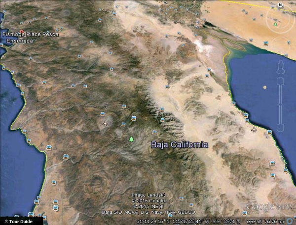
Now u can see where everything is, so u dont get lost the next time u are touring people around guys- I and a friend were leading a hiking group once in the middle of whiteout conditions where we we had to split up the group because it was so large and the guy leading the other 1/2 got lost despite having much more experience (being several decades older-kind of funny his getting lost- at the time he was my best friend -since my 'peers' were still too preoccupied by Freuds vaunted botched potty training and we had been through many blizzards together)
The green tree denotes the National Sierra San Pedro Martin National park where the observatory is located. As usual no extra charge.
Upper right the terminus of the Colorado river, though the river dries up-last drop used for crops and Mexicali etc before it ''hits'' the gulf of Calif
Mexico receives 10% of the water by treaty.
You should be able to locate CWRN on the map by now.


 (0)
(0) (0)
(0)