this was discovered by Madflights excellent resear
Post# of 8059

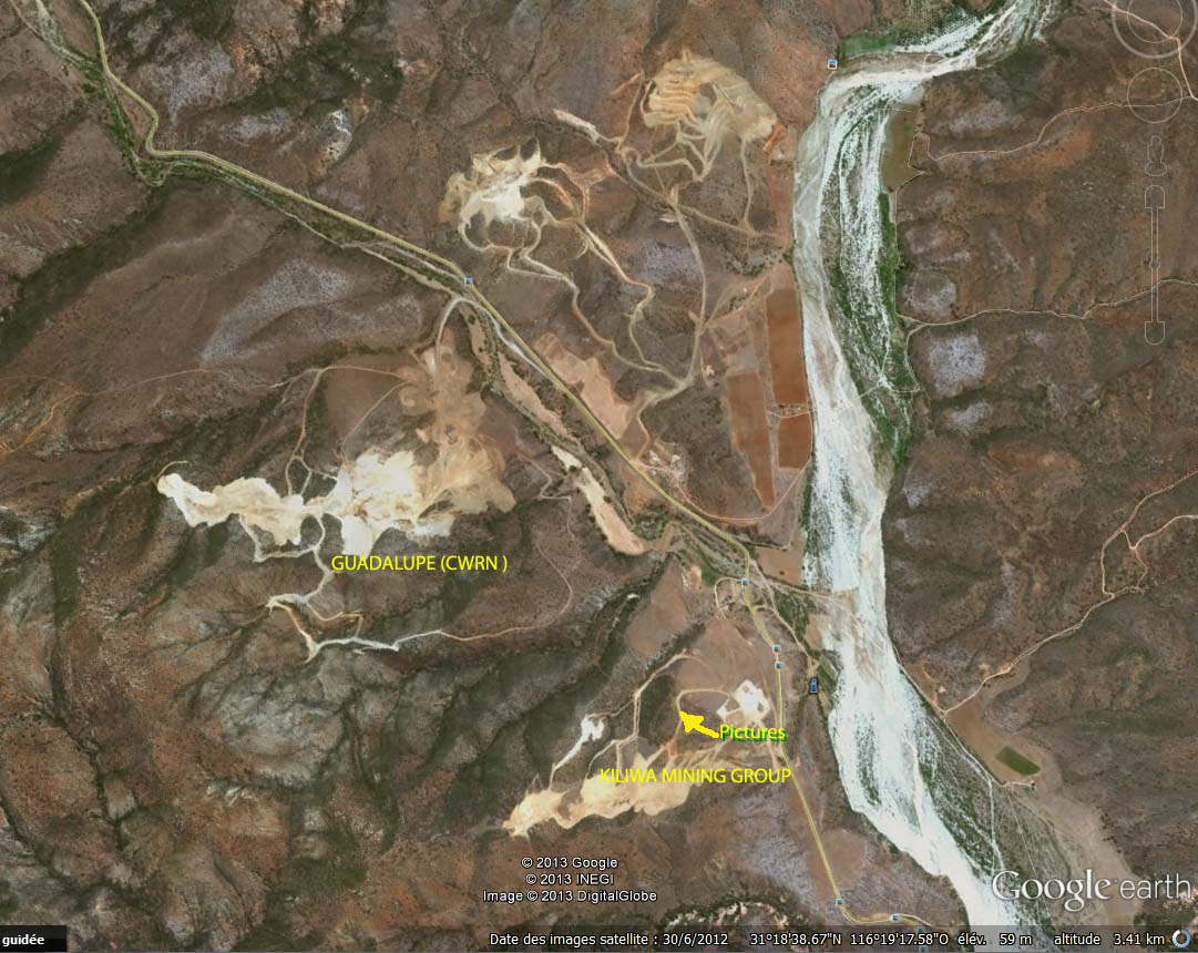
this was discovered by Madflights excellent research- Navial completely surrounds Baja 4 and surrounds Baja 14-the operating mine-on 2 sides
the big river or wadi here on the right from N to S is the San Vicente River-named after an agricultural town of ca 12000 upstream- which is dry most of the summer- the S 1/2 of Baja 14 -not yet mined-w veins of its own, is on the right side of the San Vicente R --
the small river which follows the secondary highway and the N 1/2 of Baja 14 is the Gaudalupe River-in between the 2 rivers N of the fork is the iron mine which gave up- CWRN may have obtained part of that concession ca Sept 2011-see Sept 2011 PR
KMG took some pics of area N from area noted as pics on KMG site -I think the earth moving on KMG site is new - pic is dated 6-30-12-I just posted this so I could add explanatory comments to make it meaningful- madflight- post the pics u found if you want

 (0)
(0) (0)
(0)