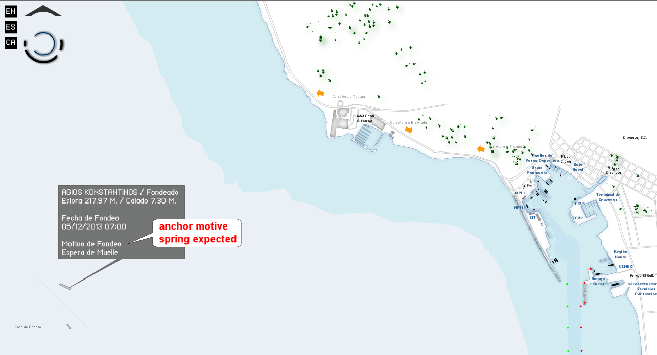
A very handy interactive map, indeed. It's on the
Post# of 8059
A very handy interactive map, indeed. It's on the Port of Ensenada site, if you dig for it. Iggyman posted the link here a little while back. :-)
To see the anchorage location, zoom out or pan left. Holding CTRL and SHIFT while clicking on the map allow you to zoom. The red text in the balloon is a quick translation of the Spanish text.
Still don't know what the cargo will be, but I solved the 2 day mystery of where this ship disappeared to, at least. All of the usual ship tracking sites showed no coordinates since 12/3 09:32.
To be honest, I'm not expecting much from the Agios K, but I'm providing links to the tools and data sources to help others in the future. Teach a man to fish...

 (0)
(0) (0)
(0)