Posted On: 09/26/2013 11:01:42 PM
Post# of 8059
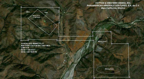
N 1/2 baja 14 -left side of pic-is being mined -CWRN hasnt touched S 1/2-right side-so mining areas shown reflected prior concession owner Cemex operations-or maybe even a prior concession to cemex- all of 73 drill holes were I think for N1/2 though 4 were outside of pre 2011 boundaries- but there are a lot of iron outcrops that may have had incipient mining on S side
200' wide corridor connects 2 halves of concession w part of river in S 1/2 though additional environment considerations would probably apply to the river,which is often dry, more like a wadi
as you can see they have only touched on a small part of this concession re mining-and only near the surface in most places at that and they have other concessions also


