Posted On: 08/06/2013 3:48:16 PM
Post# of 8059

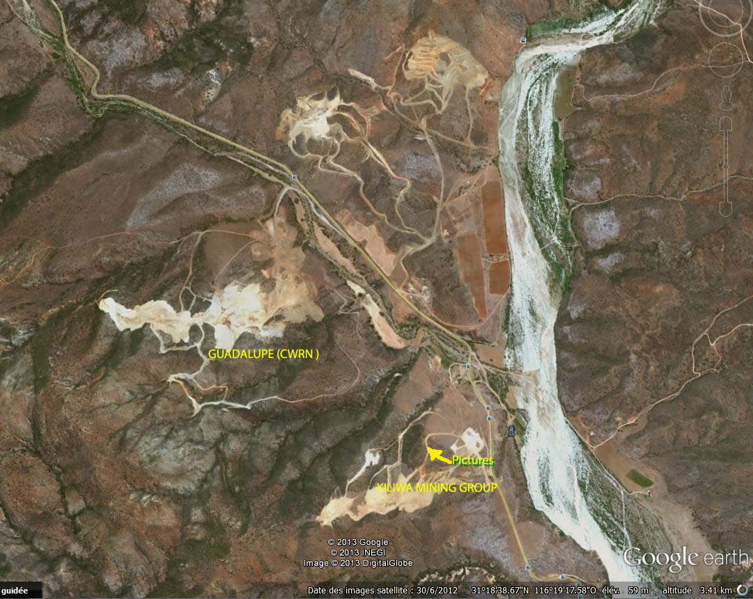
shows N 1/2 of Baja 14-the paved highway runs N ca 5.5 miles to junction w Highway 1 and West ca 9 miles to the coastal village of Erendira,where some of CWRN's workers live. The big river is the often dry in the summer San Vicente River,which borders the S side of Erendira as it flows into the ocean.