Posted On: 03/22/2015 7:46:18 PM
Post# of 8059

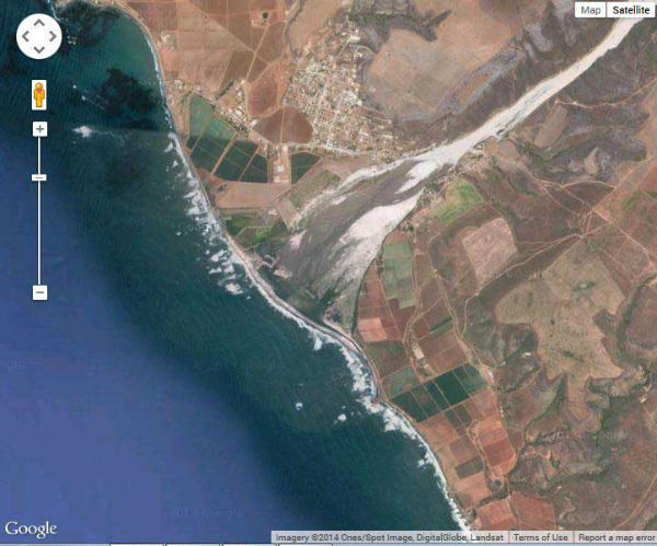
The San Vicente River passes by a town of ca 12000? of the same name on hwy 1 few miles E of CWRN and splits the baja mine in 2 and proceeds to just S of Erendira so the Erendira pics were all looking N from just N of the wide wadi /estuary of the San Vicente River-
because the road to Erendira from hwy 1 and CWRN is on N side of the river and the deeper than usual water just offshore where a shiploading station would be -which is why we asked Leross to take pics looking N so we could see the landslope to the possible shiploading area
best map i've found of N Baja is Nat Geographic Baja North Adventureland map 3103 1:450,000 scale
-and again thanks to leross/rkc for doing so for they are the 1st pics by stockholder visitors of that Erendira area only 6miles from CWRN mine- and of course the estuary would produce shallow water offshore
San Vicente River is dry much of the time despite being 1 of the bigger rivers in the area and despite getting its water from the wet side of the mountains inland from CWRN-