Posted On: 01/06/2014 3:25:50 AM
Post# of 8059

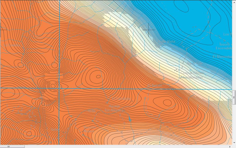
On the tenth try I finally got this closer 200% resolution 50k scale shot of CWRN mine uploaded,not having done anything different than 1st 9 tries. "if at 1st u dont succeed try again mr kidd" as a james bond movie I saw decades ago said-think it was 1971.
N 1/2 of Baja 14 mine in production is N of San Vicente River, which runs thru the abandoned corpus christi settlement,which is East-to right- of mine.
The highway bordering CWRN on W is much easier to see at this resolution-I've placed it ca 1" from left end of screen. The very very very common Guadalupe place name is off map to the N/top,as is another Corpus Christi place name.
The S 1/2 of Baja 14 -same size as N1/2- is S of San Vicente River -joined by a 200 meter wide corridor, but vast majority of S1/2 is not on this screen, so I could show a closer view.
Red is higher concentrations of iron discovered via aerial magnetometer surveys,apparently by the govt, as part of the concession process,w blue being lesser concentrations-but ground sampling/ drilling/ surveys and induced polarization are much more accurate.