Posted On: 01/05/2014 7:46:13 AM
Post# of 8059

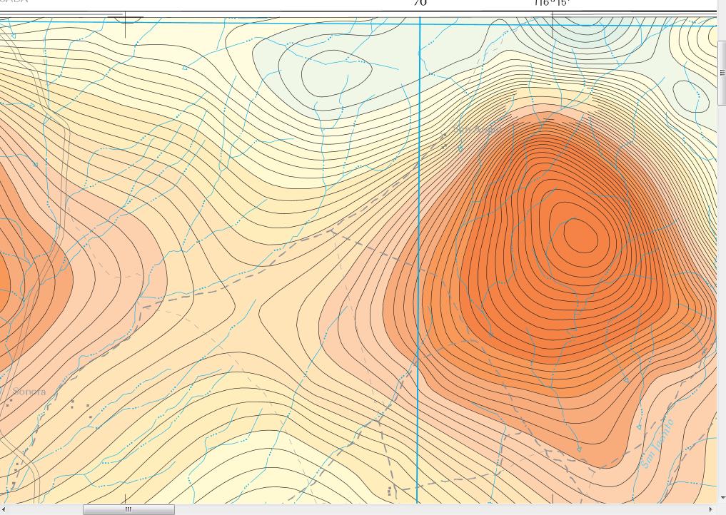
closer view of mine area 200% scale of 50k scale map -can see road bordering mine to W - on said road N 5.5 mi to junction w Hwy 1 to Ensenada and the other way -S-leads to Erendira in ca 9 road miles
and in SE left lower corner can see what they call the san jacinto river here -what other sources call the San Vicente River-sometimes things have 3 names-what non- Mexican sources call it -what Mexicos national sources name it and what locals call it -so can be very confusing
these are essentially geo overlays of topo maps
since these are magnetic maps I assume the color codings reflect the incidence of how much iron reflected by magnetometer readings -w most red being highest readings and most blue being lowest readings -these presumed flyover readings are of course not nearly as accurate as ground surveys/readings,induced polarization and drilling
Surprising number of "streams" indicated on these maps but they are mostly dry wadis I think,as even the biggest river -San Vicente/San Jacinto is usually dry in summer and probably fall
may have to tweak some more another day