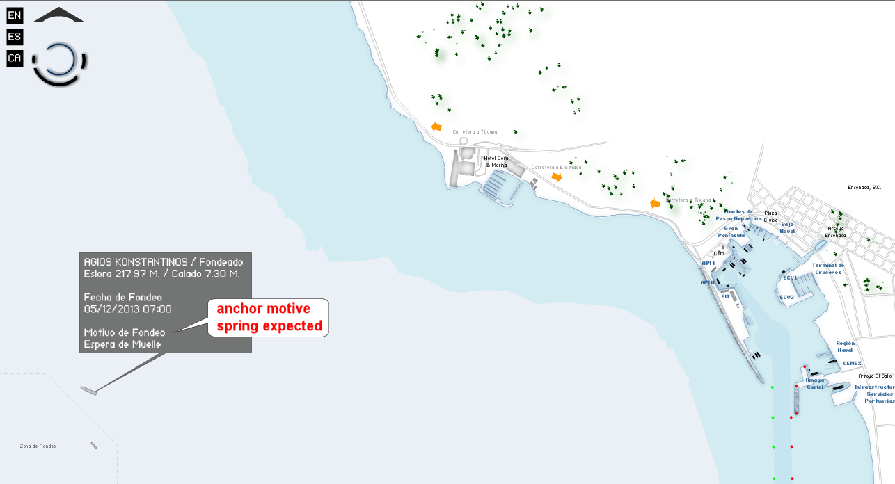
A very handy interactive map, indeed. It's on the Port of Ensenada site, if you dig for it. Iggyman posted the link here a little while back. 
To see the anchorage location, zoom out or pan left. Holding CTRL and SHIFT while clicking on the map allow you to zoom. The red text in the balloon is a quick translation of the Spanish text.
Still don't know what the cargo will be, but I solved the 2 day mystery of where this ship disappeared to, at least. All of the usual ship tracking sites showed no coordinates since 12/3 09:32.
To be honest, I'm not expecting much from the Agios K, but I'm providing links to the tools and data sources to help others in the future. Teach a man to fish...

